
About me
I am a Geography and Spatial Planning graduate from the University of Oviedo, with a Master’s degree in Territorial Resources and Planning Strategies from the Universities of Oviedo and Cantabria. With over 10 years of professional experience in GIS and cartography at GeoNalón, I specialize in spatial analysis, data visualization, and territorial management.
My expertise includes the design and management of geographic databases in various formats, including PostGIS. I am skilled in data collection through fieldwork -using techniques such as GPS-, data analysis, and the development of web-based GIS applications. I have experience creating both public and private web viewers with GeoServer and Leaflet, enabling seamless data exploration and decision-making.
Portfolio
Feel free to explore my portfolio to learn more about my work and expertise.
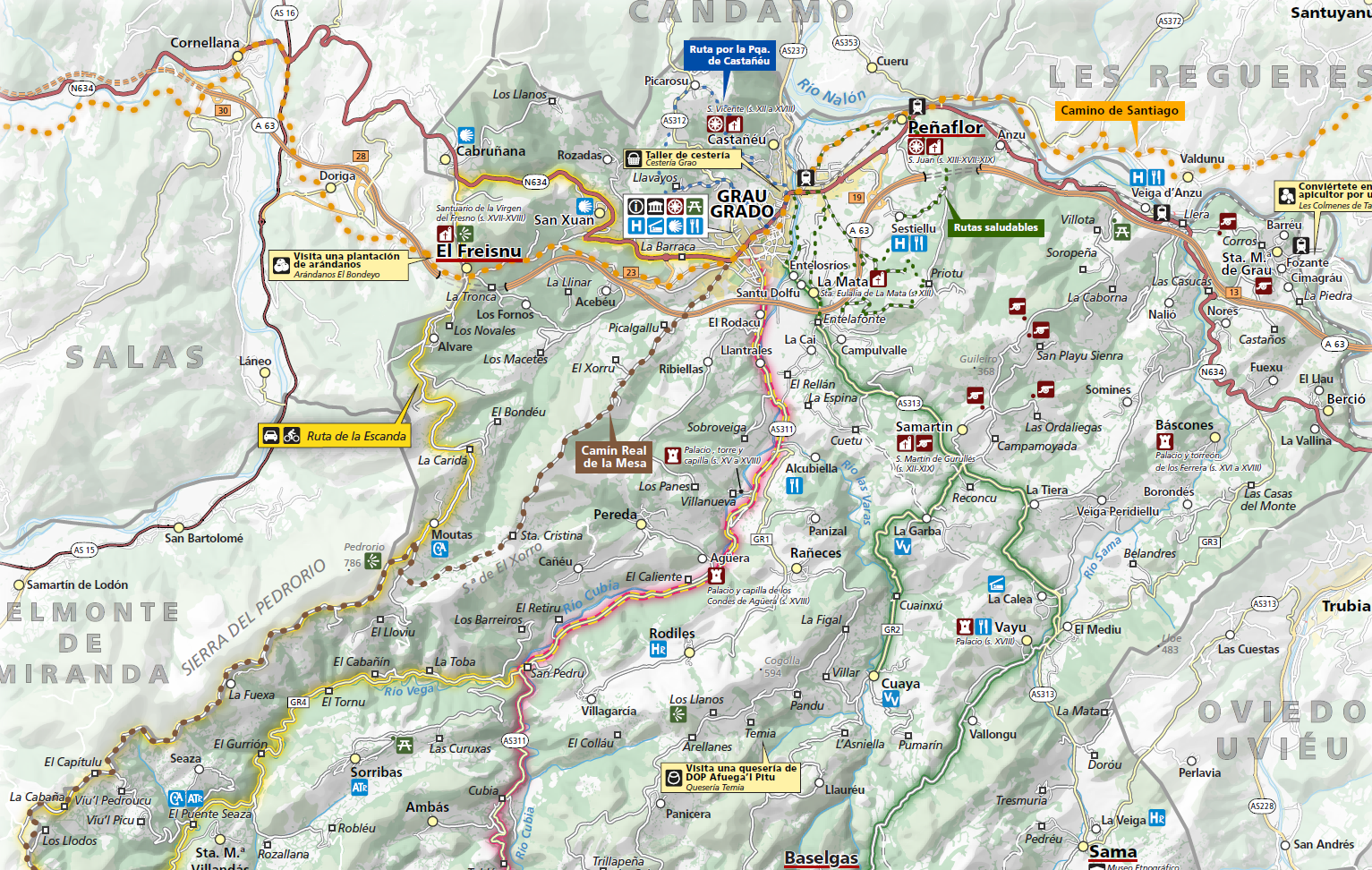
Grao municipality tourist resources map
Project: Grao Tourist Brochure
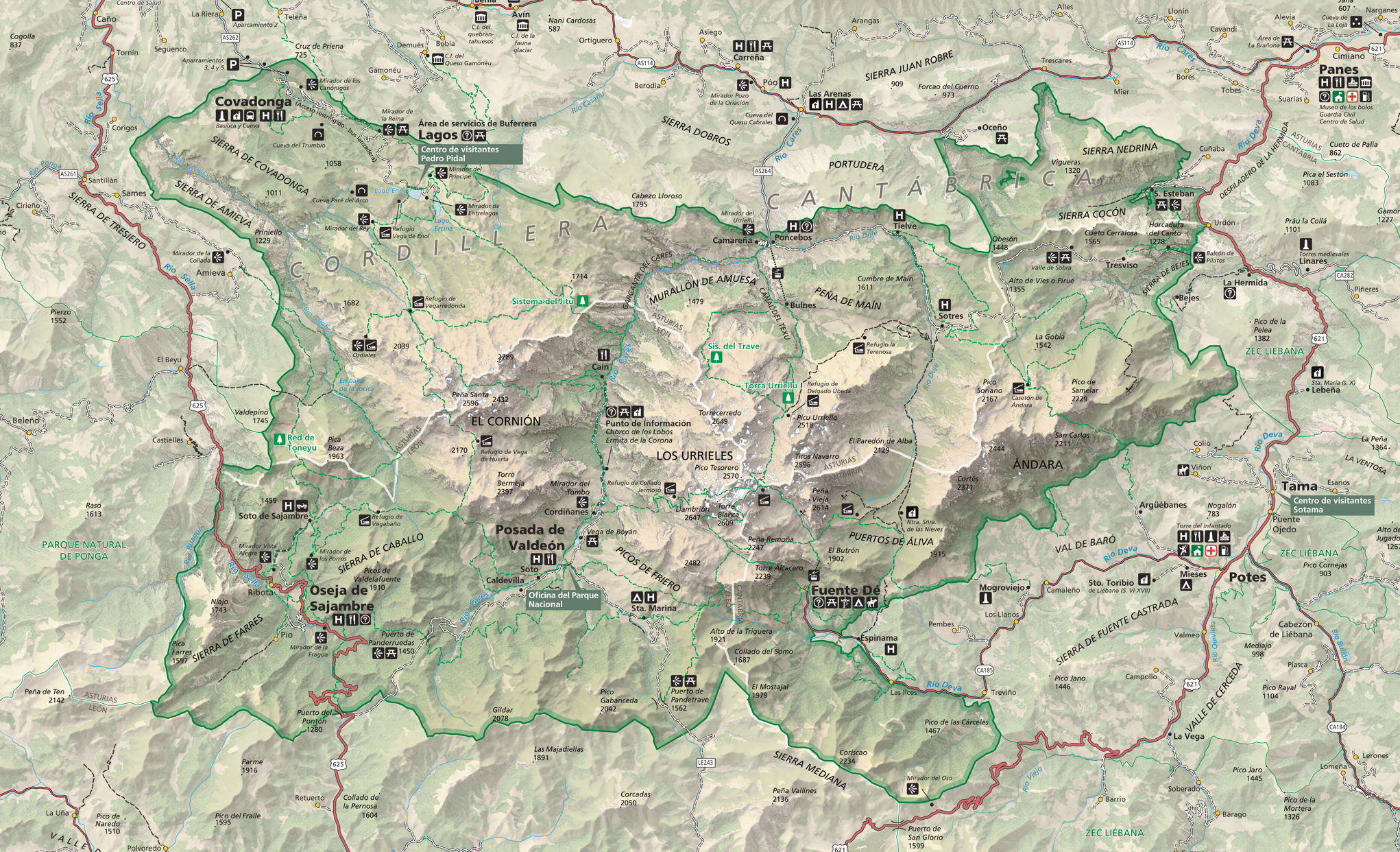
Picos de Europa National Park Map
Project: Picos de Europa National Park Map
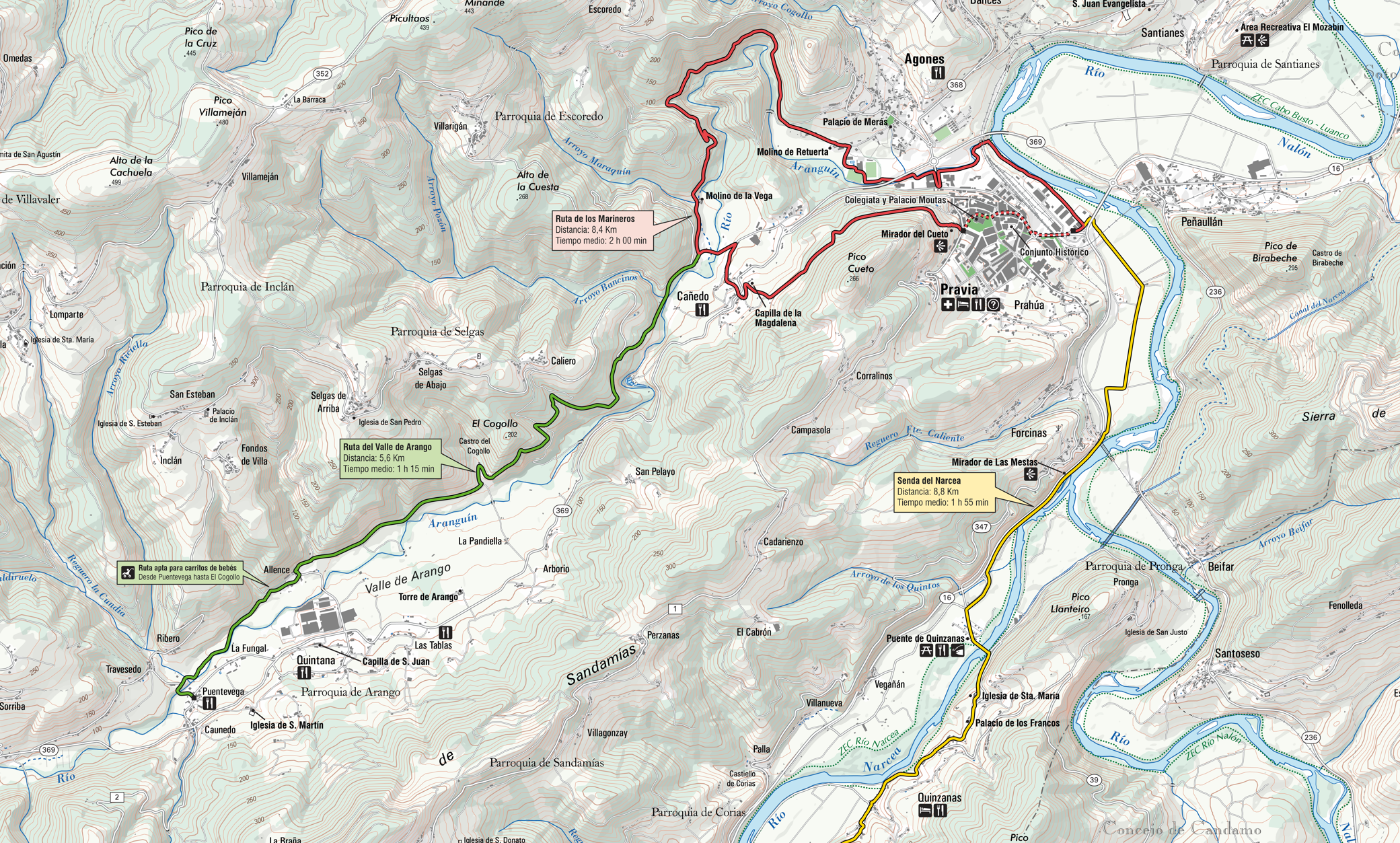
Hiking Trail Map
Project: Hiking Trails in Pravia Brochure
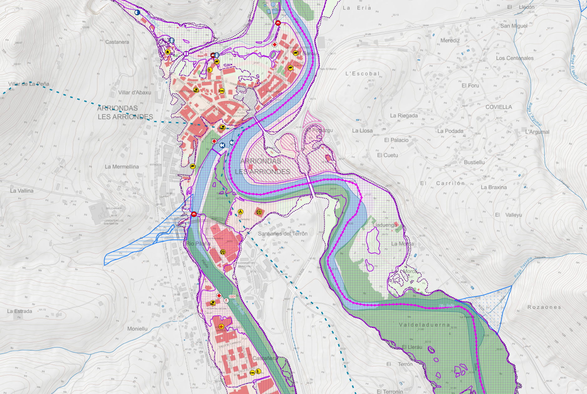
Flooding Risk and Hazard Map
Project: Flooding Prevention Plan
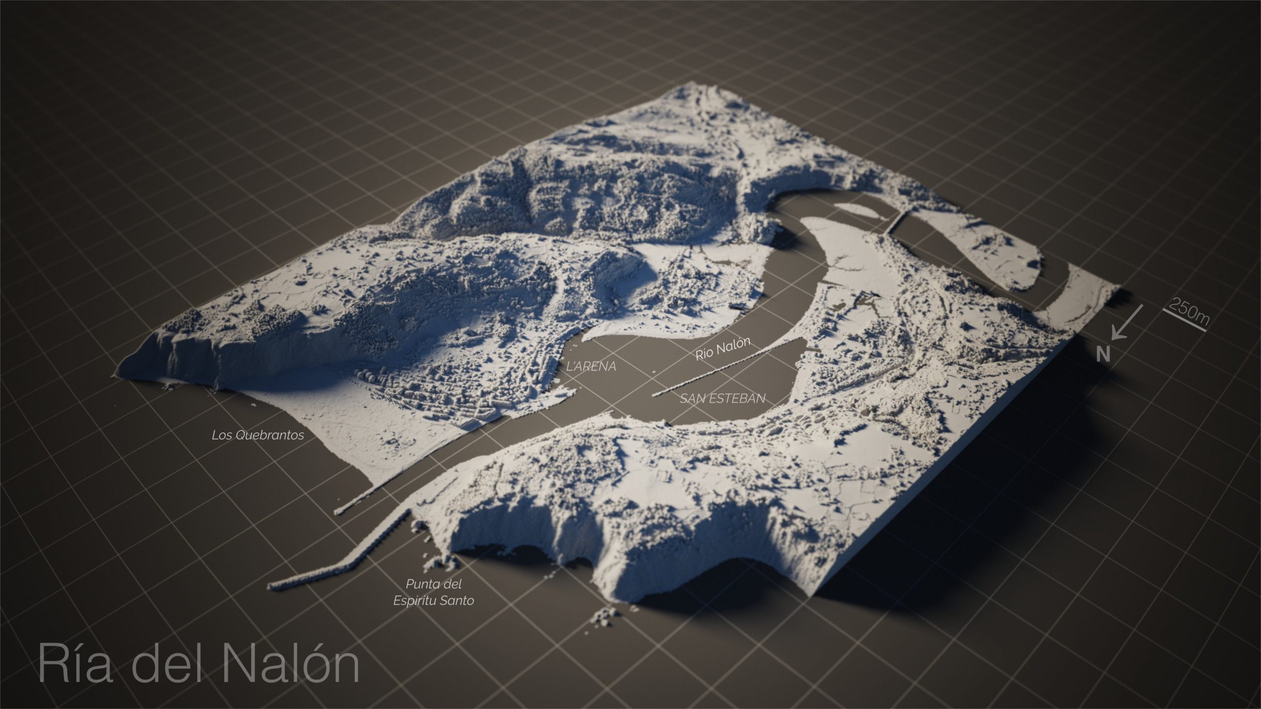
3D Model of Nalon Stuary
Project: DSM
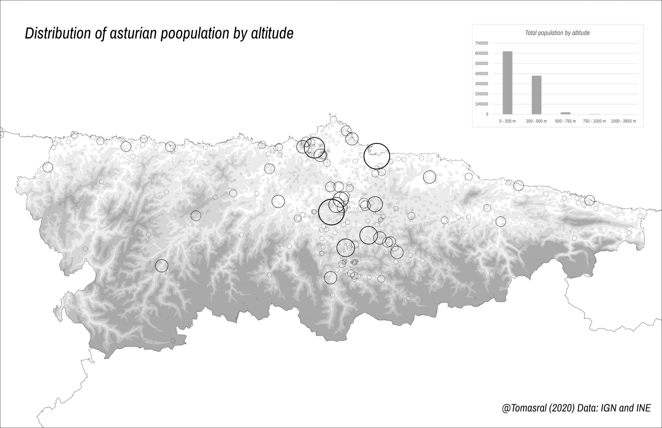
Distribution of asturian population by altitude
Project: Asturias Population
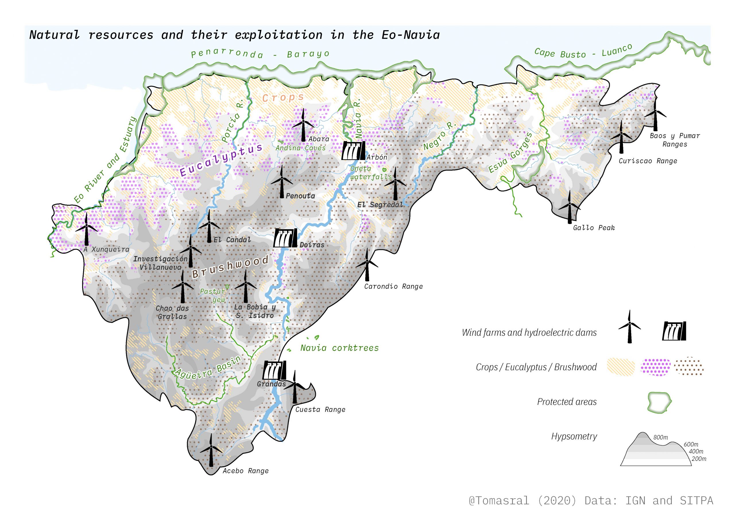
Natural Resources Map
Project: Eo-Navia Geographic Characterization
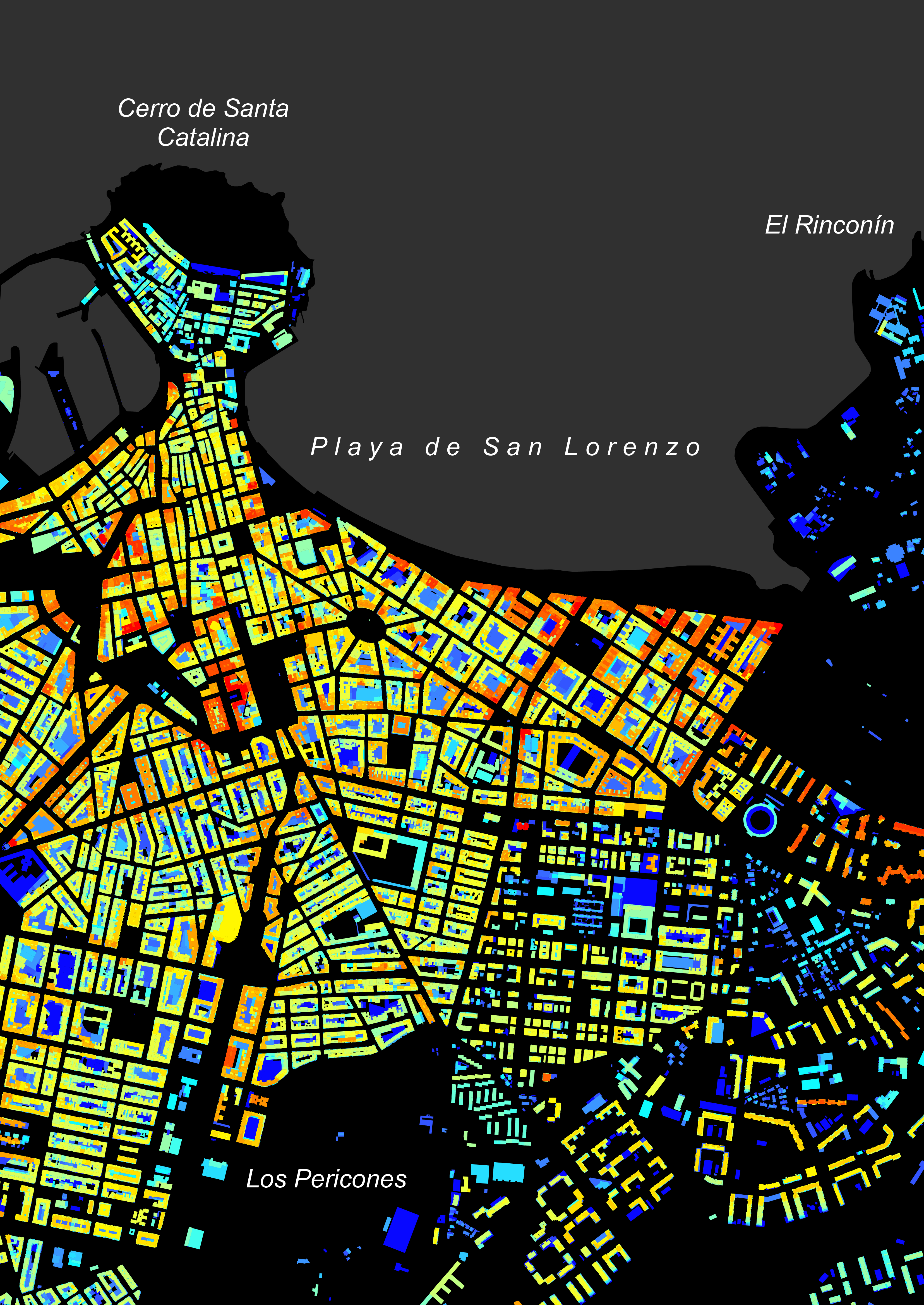
Building Height Map
Project: Xixón Urban Analysis
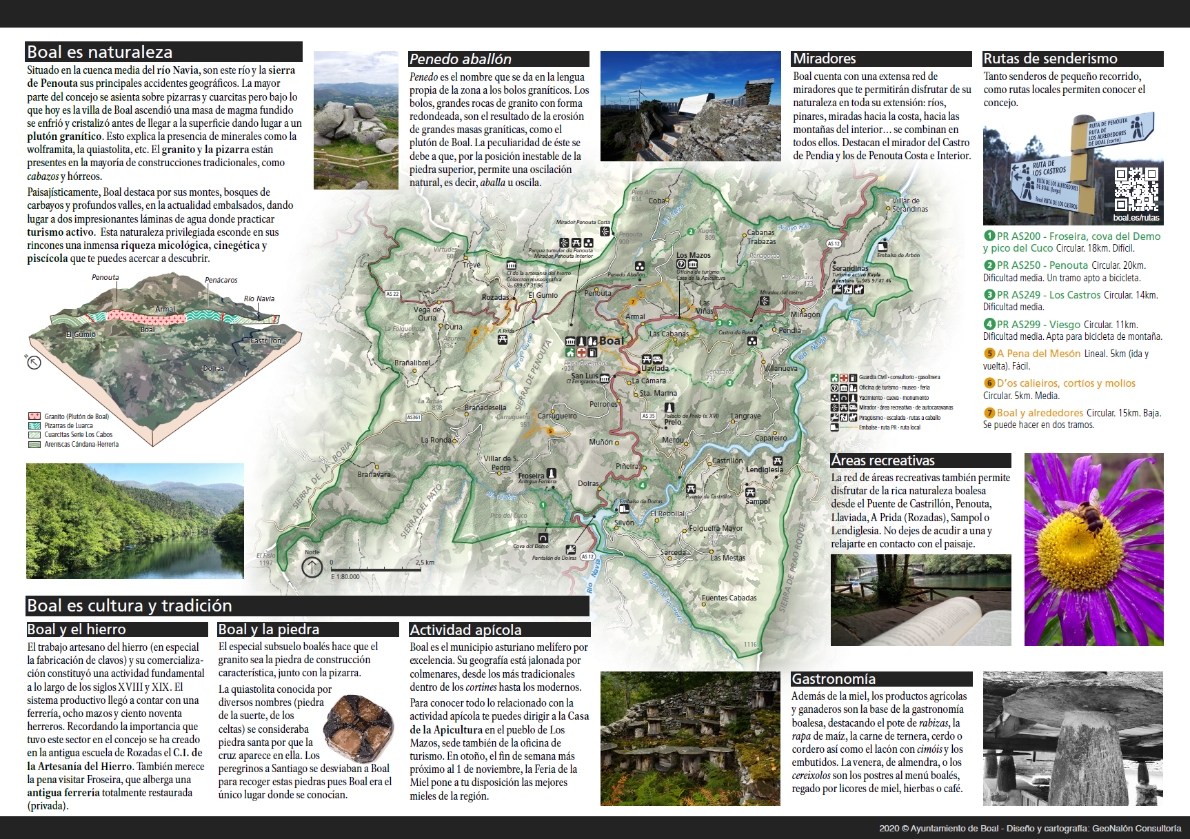
Boal Tourist Resources Map
Project: Boal Tourist Brochure
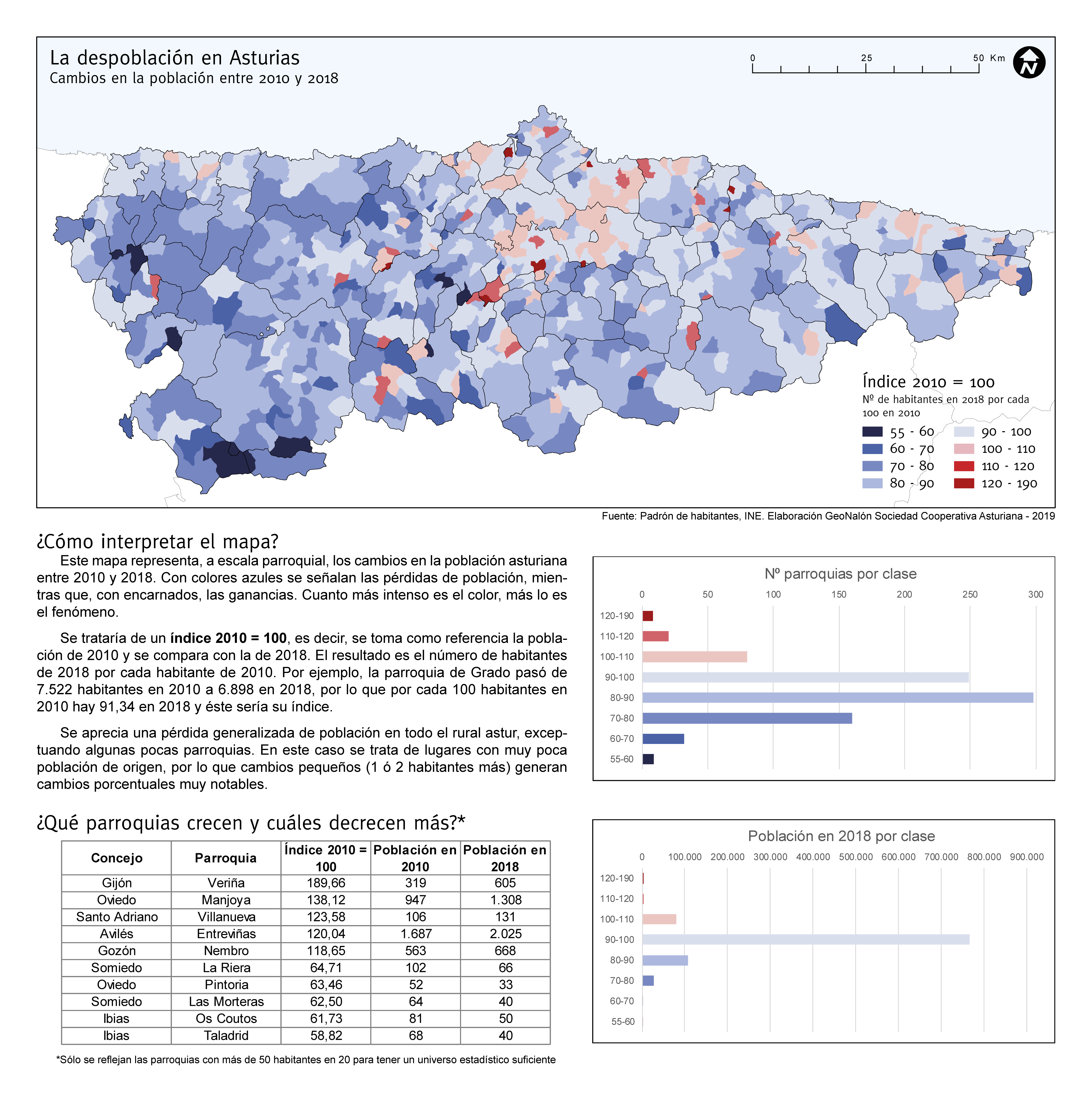
Depopulation in Asturias. Population changes between 2010 and 2018
Project: Asturias Population
Contact me

Currently based in Asturias, Spain

me@tomasral.es